


MORAINE 225 Voting District, Lake County, Illinois
About
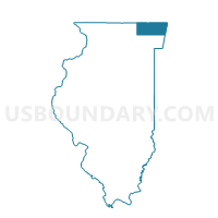
Outline

Summary
| Unique Area Identifier | 572417 |
| Name | MORAINE 225 Voting District |
| County | Lake County |
| State | Illinois |
| Area (square miles) | 0.44 |
| Land Area (square miles) | 0.43 |
| Water Area (square miles) | 0.01 |
| % of Land Area | 98.85 |
| % of Water Area | 1.15 |
| Latitude of the Internal Point | 42.15688110 |
| Longtitude of the Internal Point | -87.79299240 |
Maps


Graphs
Select a template below for downloading or customizing gragh for MORAINE 225 Voting District, Lake County, Illinois


Neighbors
Neighoring Voting District (by Name) Neighboring Voting District on the Map
- MORAINE 219 Voting District, Lake County, IL
- MORAINE 224 Voting District, Lake County, IL
- MORAINE 226 Voting District, Lake County, IL
- MORAINE 227 Voting District, Lake County, IL
- New Trier 2 Voting District, Cook County, IL
- New Trier 62 Voting District, Cook County, IL
- Northfield 55 Voting District, Cook County, IL
Top 10 Neighboring County Subdivision (by Population) Neighboring County Subdivision on the Map
- Northfield township, Cook County, IL (85,102)
- New Trier township, Cook County, IL (55,424)
- Moraine township, Lake County, IL (34,129)
Top 10 Neighboring Place (by Population) Neighboring Place on the Map
Top 10 Neighboring Elementary School District (by Population) Neighboring Elementary School District on the Map
- North Shore School District 112, IL (35,413)
- Northbrook School District 28, IL (13,883)
- Glencoe School District 35, IL (8,528)
Top 10 Neighboring Secondary School District (by Population) Neighboring Secondary School District on the Map
- Northfield Township High School District 225, IL (85,747)
- New Trier Township High School District 203, IL (59,796)
- Township High School District 113, IL (58,323)
Top 10 Neighboring State Legislative District Lower Chamber (by Population) Neighboring State Legislative District Lower Chamber on the Map
Top 10 Neighboring State Legislative District Upper Chamber (by Population) Neighboring State Legislative District Upper Chamber on the Map
Top 10 Neighboring 111th Congressional District (by Population) Neighboring 111th Congressional District on the Map
Top 10 Neighboring Census Tract (by Population) Neighboring Census Tract on the Map
- Census Tract 8002, Cook County, IL (6,312)
- Census Tract 8015, Cook County, IL (5,928)
- Census Tract 8657, Lake County, IL (5,781)
- Census Tract 8658.01, Lake County, IL (3,084)